Easter long weekend cruise on the ice roads on Great Slave Lake (Yellowknife, Northwest Territories).
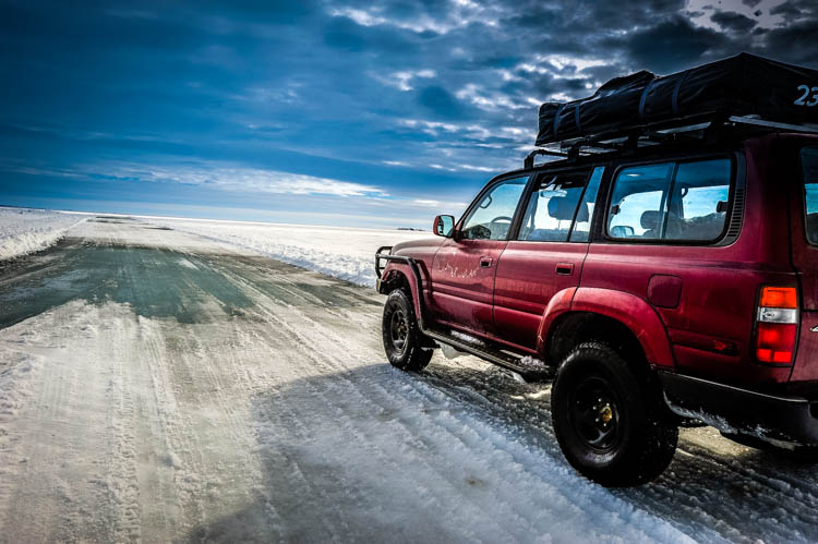
This 110km long and 1.1m thick ice road heads from Yellowknife to the Vital Metals Ltd. Nechalacho rare earths project at Thor Lake near the Hearne Channel of Great Slave Lake. All heavy equipment for the mine was transported on this road.
On Saturday (May 8th) the light was poor and road conditions made road difficult to drive. Actually quite difficult to see the road. On Sunday (May 9th) the road was freshly plowed and sunny sky. We drove the Yellowknife – Devils Channel (Gros Cap) section (75km) and skied 11km in Devil’s Channel that separates Gros Cap from the mainland. No other traffic on the road. On the return, due to the warm temperatures in the afternoon and cooling evening temperatures the large and deep puddles on the crystal clear ice were partially frozen – peppering the hood and windshield with chunks of ice. The ice road was closed 12hours after we got home.
Anticipating that things can go wrong on a remote ice road, we brought safety and survival gear, including the rooftop tent, -30C sleeping bags, warm clothes, food, stove, inreach, extra fuel, winch, ice screws, towing strap, and Maxtracks.
Pictures from Saturday:
Pictures from (sunny) Sunday:


