Alaska Highway – Muncho Lake, British Columbia

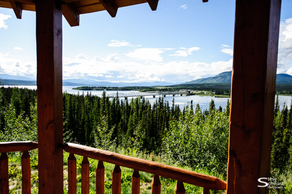
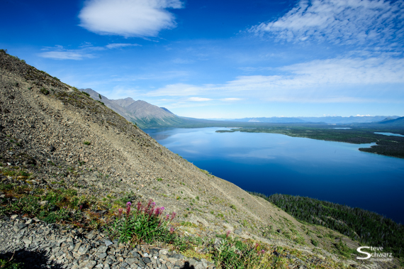
Muncho Lake, part of the Muncho Lake Provincial Park is located at kilometre 681 (mile 423) of the Alaska Highway in northern British Columbia, Canada.

DSCN7046-2

Even on a cloudy day day, the views are still incredible.

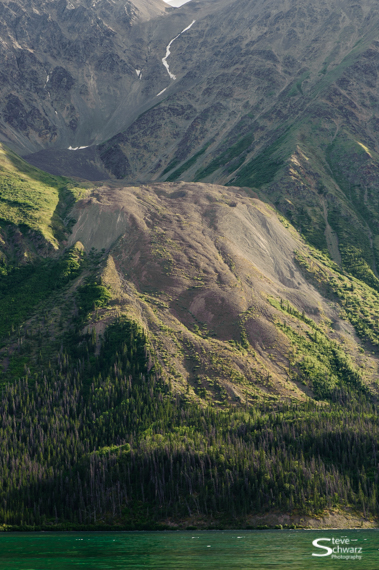
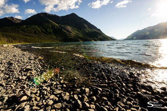
The distinctly jade green colored lake, tinted green by minerals is about 12 km (7.5 mi) long and between 1 and 6 km wide, and is home to lake trout, arctic grayling, bull trout and whitefish. Muncho Lake is surrounded by Terminal Mountain Range to the west and the Sentinel Mountain Range to the east. The tallest mountains reach heights of more than 2,000 m (6,600 ft), and lake level is at an elevation of 820 m (2,690 ft). Many of the mountains were formed by folded layers of limestone and have broad alluvial fans created by powerful floods.

SCH_9823-2

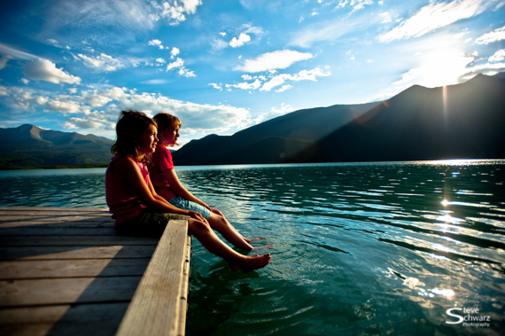
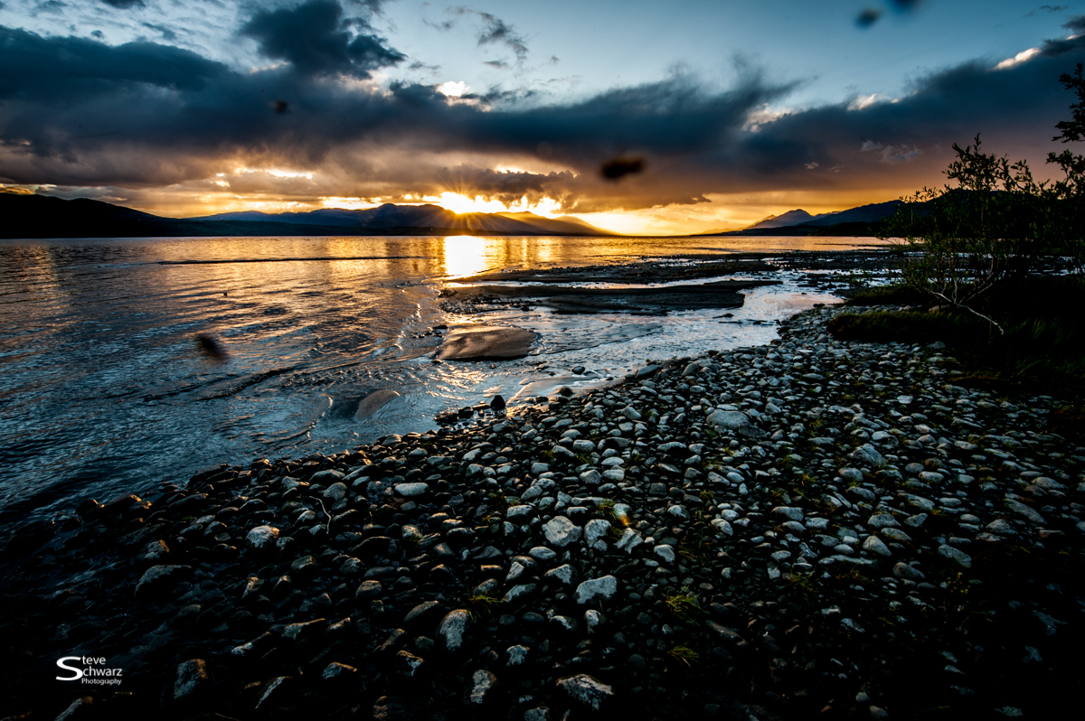
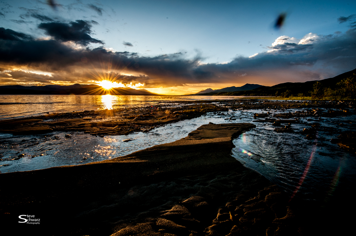
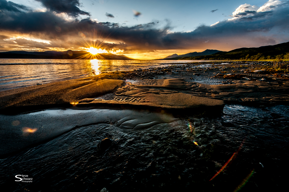
Watching the sun go down from the dock at Muncho Lake. That water is Cold !


We camped at Strawberry Flats campground, August 4th 2013, and during the night, the northern lights put on a show !.


SCH_9879

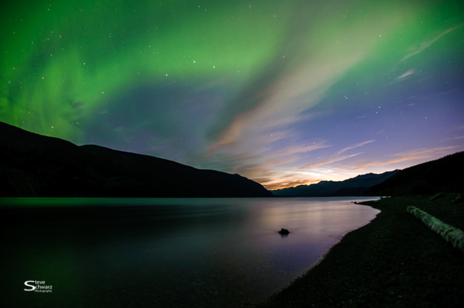
Northern Lights over the dock at Muncho Lake; jade colored sky over a jade colored Muncho Lake. Nikon D700 with Nikon 17-35mm lens; 30 second exposure, f/2.8, ISO 1250.

SCH_9895-2

Northern Lights a glassy Muncho Lake. Nikon D700 with Nikon 17-35mm lens; 25 second exposure, f/2.8, ISO 800.


SCH_9903

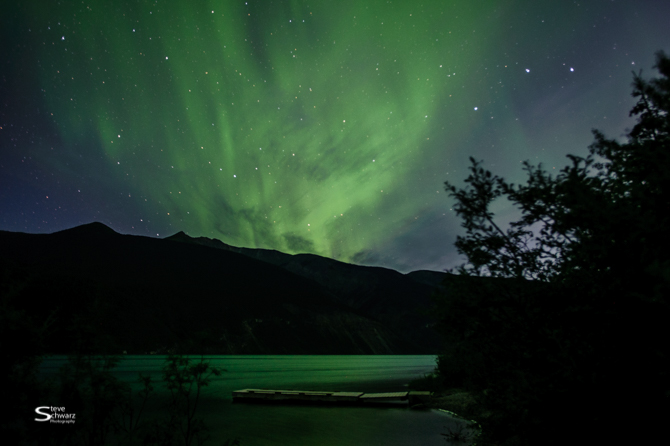
Red and blue lights from the interior of the RV contrast with the green of the northern lights over Muncho Lake, August 4th, 2013. Nikon D700 with Nikon 17-35mm lens; 30 second exposure, f/2.8, ISO 1250.

SCH_9884

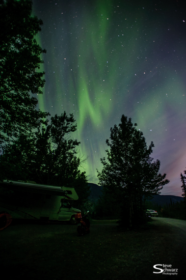
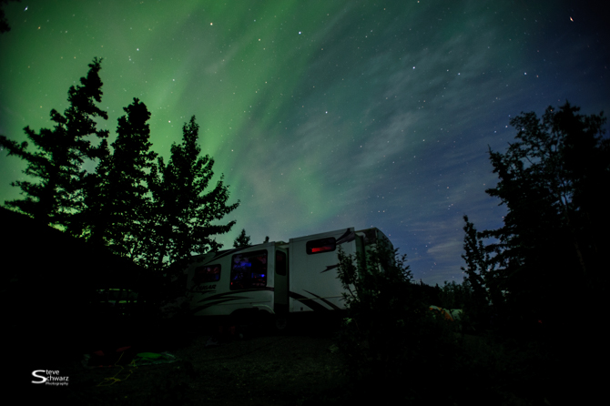
Northern Lights lighting up the the sky over a RV camper at Strawberry Flats campground, Muncho Lake, August 4th, 2013. Nikon D700 with Nikon 17-35mm lens; 20 second exposure, f/2.8, ISO 1600.

SCH_9906

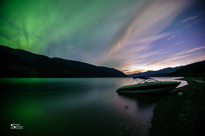
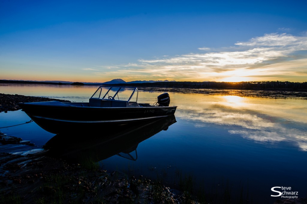
Northern lights dance across the sky above a motor boat on the shore of Muncho Lake, August 4th, 2013. Nikon D700 with Nikon 17-35mm lens; 25 second exposure, f/2.8, ISO 1000.

SCH_9914-2

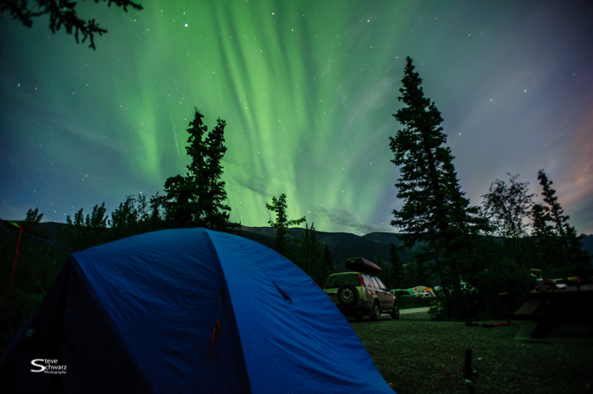
Northern lights over Strawberry Flats campground, Muncho Lake, August 4th 2013. Nikon D700 with Nikon 17-35mm lens; 25 second exposure, f/2.8, ISO 1600.


SHS_9591

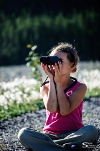
Watching for Stone sheep !

SHS_9599-2

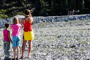
Who is watching who ?.

SHS_9620-2

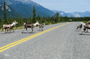
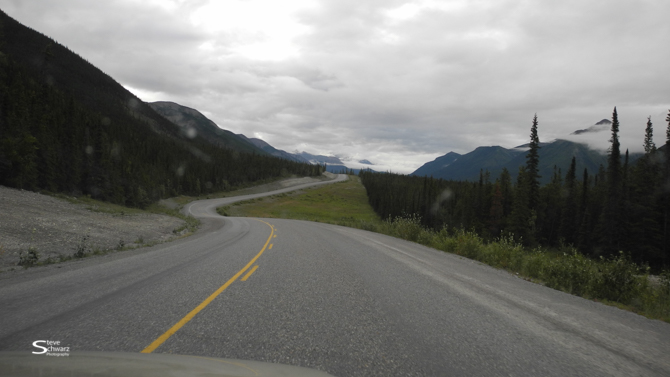
Stone sheep crossing the Alaska highway.

Alaska Highway – Teslin, Yukon

Teslin is a small village located in the Yukon Territory at historical Mile 804 (Km. 1244) on the Alaska Highway, approximately halfway between Watson Lake and Whitehorse. During the Gold Rush of 1898 Teslin was a busy place as a stopover on the Canadian route to the Klondike, and the Hudson Bay Co. established a trading post for the villagers and those traveling the Klondike trail. In 2013, Teslin had a population of approximately 450 people, and facilities include an airport, museum, RCMP Detachment, school, community centre, health unit, post office, motels, restaurants, and a general store.

We passed through on August 5th, 2013.

SHS_9642

Scenic viewpoint on a hill overlooking the Teslin and the Nisutlin Bay Bridge


SHS_9654

Cartoon signs emphasizing the importance of Salmon to the region and its people

SHS_9667

The Nisutlin Bay Bridge in Teslin, an impressive seven-arch metal span, is the longest bridge on the Alaska Highway.


SHS_9722

A netted bird, soon to be banded as part of a Canadian Wildlife Service bird banding project


Sunset on Teslin Lake. Yes – it was buggy that night, and they were all over my camera lens too. Nikon D700, Nikon 14-24mm lens, 1/25th sec f/16, ISO 400. Click image to view it larger.

Sunset on Teslin Lake. A relatively bug-free photo, by blowing on the camera lens during the exposure. Nikon D700, Nikon 14-24mm lens, 1/25th sec f/16, ISO 400. Click image to view it larger.

SHS_9706

Sunset on Teslin Lake. A relatively bug-free photo, by blowing on the camera lens during the exposure. Nikon D700, Nikon 14-24mm lens, 1/100th sec f/16, ISO 400. Click the image to view it larger.


Sunset on Teslin Lake. A relatively bug-free photo, by blowing on the camera lens during the exposure. Nikon D700, Nikon 14-24mm lens, 1/100th sec f/16, ISO 400. Click the image to view it larger.


Alaska Highway – Klaune National Park and Reserve, Yukon

Kluane National Park and Reserve (est 1972) in the southwest corner of the Yukon Territory is 150 km west of Whitehorse. The nearest community, and the location of the Visitors Centre is Haines Junction, 32km south.

The Park covers an area of nearly 22,000 square kilometers of high mountains, icefields, glasciers, crystal clear lakes and spectacular wildlife (ground squirrels, caribou, moose, grizzly and black bears, Dall sheep and mountain goats), and includes Mount Logan (5959 m/19,545 ft) Canada’s highest peak.

SCH_9999

The long road to Klaune. Nikon D700 and Nikon 17-35mm lens.

Our visit to the Kluane National Park Visitor Centre in Haines Junction (August 6th, 2013) coincided with a VIP visit by the Governor General of Canada David Johnston and Yukon Commissioner Douglas George Phillips (talking to my kids).

SCH_0043


We camped at the Kathleen Lake Campground, and the next morning headed off to hike the King’s Throne Trail.

SCH_0132

SCH_0135

Checking out the very Fresh bear POO !!

The King’s Throne hiking trail is a 15km hike with an elevation gain of 1250m (4101 ft).

SCH_0286

The King’s Throne is the plateau about half way up the mountain. The views from the Throne are of the surrounding valleys and Kathleen Lake are absolutely breathtaking.

SCH_0151

View of Kathleen Lake and mountains to the north.

SCH_0179

The King’s Throne, really a boulder strewn bowl created by glaciers.


SCH_0182

Heading down from the King’s Throne. The trail is steep with many loose rocks and boulders.

SCH_0245

SHS_9768

The King’s Throne photographed from the day-use area on Kathleen Lake

SHS_9732

Shoreline view of Kathleen Lake, with the King’s Throne in the distance.

Alaska Highway – Tetsa River, British Columbia

If you have not yet driven on the Alaska Highway – I highly recommend it !!

If you have driven the Alaska Highway,  at least the part between Fort Nelson and Muncho Lake Provincial Park in northern British Columbia, you would have passed Tetsa River at Mile 358 or Kilometre 558.

There isn’t a whole lot to do here – except fill up on gas, and spend a whole lot of money on cinnamon buns and gas…

We drove down this road August 25, 2013 as part of a road trip extending from Whitehorse to Yellowknife. All photos on this page taken with a Nikon D700 and Nikon 17-35mm lens.


SCH_1063

Alaska Highway near Muncho Lake Provincial Park


SCH_1064

Rooms for rent – real cheap !


SCH_1068

Tesla River Lodge


SCH_1070

Eating the “world famous” Cinnamon buns at the Tesla River Lodge


SCH_1071

Stuffed moose, deer, wolf and why not buy a pair of PJ’s ?


SCH_1073

No Sniveling. yes – the gas is expensive !

Alaska Highway – Blackstone Territorial Park, Northwest Territories

Blackstone Territorial Park, is a small campground located approximately 115km north of Fort Liard, and 166km south of Fort Simpson, Northwest Territories, Canada. The park is located on the bank of the Liard River and is the starting/ending point for many paddle trips and river rafters from Nahanni National Park. From the shores of the Liard River one can see the very popular Nahanni Mountain Range.

These photos from a road trip from Yellowknife to Whitehorse road trip, passing through Blackstone Territorial Park on Aug 3rd-4th, 2013. All photos on this page taken with a Nikon D700 and Nikon 14-24mm lens.

SHS_9429

View of the Nahanni Mountain Range from the Visitors Centre

SHS_9454

Enjoying the view over the Liard River and Nahanni Mountain Range from the Visitors Centre

SHS_9492

Walking along fallen trees along the shoreline of the Liard River

SHS_9520

Typical view of the Liard Highway. Yes – it is a gravel road

SHS_9502-2

Photo Stock: Making Money For Stock agencies

Like many young, inexperienced and downright naive photographers, I dreamed of making a living from selling photos to stock agencies.

A few years ago, my dream took a step forward, with the “invitation” to submit photo to Getty Images. Had i made it big ?. Somehow, a photo editor at Getty Images had discovered my photos, and selected 25 to be submitted to the Getty Stock pool.

“Whoo Hoo – making money”. I said.

A couple of weeks later, another invitation arrived for 30 images, and a few months later, even more requests.

So, now two years later, and approximately  120 images submitted to Getty Images, Yes -I am making money selling stock images.

Check out my April 2014 Statement.

Three images sold !!! …for a whopping $63.61

Aetty_Images


No, that big money isn’t for my pocket, as 80% goes to the stock agency.  My take-home pay is $12.66 which works out to enough money to buy breakfast, one breakfast for the month of April !.

20% to the photographer  – Really ?? .


Now – Time to wake up !. To make a living; food, housing, etc….that works out to a whole lot of photos that need to be sold to survive.

A colleague mentioned to me, what if the stock agency actually sold more of your images though didn’t tell you. Oh – now the plot thickens.

Ever heard of a stock agency that sells photos on your behalf, and doesn’t tell you ?. Does this Really happen ?