Alaska Highway – Muncho Lake, British Columbia

Muncho Lake, part of the Muncho Lake Provincial Park is located at kilometre 681 (mile 423) of the Alaska Highway in northern British Columbia, Canada.

DSCN7046-2

Even on a cloudy day day, the views are still incredible.

The distinctly jade green colored lake, tinted green by minerals is about 12 km (7.5 mi) long and between 1 and 6 km wide, and is home to lake trout, arctic grayling, bull trout and whitefish. Muncho Lake is surrounded by Terminal Mountain Range to the west and the Sentinel Mountain Range to the east. The tallest mountains reach heights of more than 2,000 m (6,600 ft), and lake level is at an elevation of 820 m (2,690 ft). Many of the mountains were formed by folded layers of limestone and have broad alluvial fans created by powerful floods.

SCH_9823-2

Watching the sun go down from the dock at Muncho Lake. That water is Cold !


We camped at Strawberry Flats campground, August 4th 2013, and during the night, the northern lights put on a show !.


SCH_9879

Northern Lights over the dock at Muncho Lake; jade colored sky over a jade colored Muncho Lake. Nikon D700 with Nikon 17-35mm lens; 30 second exposure, f/2.8, ISO 1250.

SCH_9895-2

Northern Lights a glassy Muncho Lake. Nikon D700 with Nikon 17-35mm lens; 25 second exposure, f/2.8, ISO 800.


SCH_9903

Red and blue lights from the interior of the RV contrast with the green of the northern lights over Muncho Lake, August 4th, 2013. Nikon D700 with Nikon 17-35mm lens; 30 second exposure, f/2.8, ISO 1250.

SCH_9884

Northern Lights lighting up the the sky over a RV camper at Strawberry Flats campground, Muncho Lake, August 4th, 2013. Nikon D700 with Nikon 17-35mm lens; 20 second exposure, f/2.8, ISO 1600.

SCH_9906

Northern lights dance across the sky above a motor boat on the shore of Muncho Lake, August 4th, 2013. Nikon D700 with Nikon 17-35mm lens; 25 second exposure, f/2.8, ISO 1000.

SCH_9914-2

Northern lights over Strawberry Flats campground, Muncho Lake, August 4th 2013. Nikon D700 with Nikon 17-35mm lens; 25 second exposure, f/2.8, ISO 1600.


SHS_9591

Watching for Stone sheep !

SHS_9599-2

Who is watching who ?.

SHS_9620-2

Stone sheep crossing the Alaska highway.

Alaska Highway – Teslin, Yukon

Teslin is a small village located in the Yukon Territory at historical Mile 804 (Km. 1244) on the Alaska Highway, approximately halfway between Watson Lake and Whitehorse. During the Gold Rush of 1898 Teslin was a busy place as a stopover on the Canadian route to the Klondike, and the Hudson Bay Co. established a trading post for the villagers and those traveling the Klondike trail. In 2013, Teslin had a population of approximately 450 people, and facilities include an airport, museum, RCMP Detachment, school, community centre, health unit, post office, motels, restaurants, and a general store.

We passed through on August 5th, 2013.

SHS_9642

Scenic viewpoint on a hill overlooking the Teslin and the Nisutlin Bay Bridge


SHS_9654

Cartoon signs emphasizing the importance of Salmon to the region and its people

SHS_9667

The Nisutlin Bay Bridge in Teslin, an impressive seven-arch metal span, is the longest bridge on the Alaska Highway.


SHS_9722

A netted bird, soon to be banded as part of a Canadian Wildlife Service bird banding project


Sunset on Teslin Lake. Yes – it was buggy that night, and they were all over my camera lens too. Nikon D700, Nikon 14-24mm lens, 1/25th sec f/16, ISO 400. Click image to view it larger.

Sunset on Teslin Lake. A relatively bug-free photo, by blowing on the camera lens during the exposure. Nikon D700, Nikon 14-24mm lens, 1/25th sec f/16, ISO 400. Click image to view it larger.

SHS_9706

Sunset on Teslin Lake. A relatively bug-free photo, by blowing on the camera lens during the exposure. Nikon D700, Nikon 14-24mm lens, 1/100th sec f/16, ISO 400. Click the image to view it larger.


Sunset on Teslin Lake. A relatively bug-free photo, by blowing on the camera lens during the exposure. Nikon D700, Nikon 14-24mm lens, 1/100th sec f/16, ISO 400. Click the image to view it larger.


Alaska Highway – Klaune National Park and Reserve, Yukon

Kluane National Park and Reserve (est 1972) in the southwest corner of the Yukon Territory is 150 km west of Whitehorse. The nearest community, and the location of the Visitors Centre is Haines Junction, 32km south.

The Park covers an area of nearly 22,000 square kilometers of high mountains, icefields, glasciers, crystal clear lakes and spectacular wildlife (ground squirrels, caribou, moose, grizzly and black bears, Dall sheep and mountain goats), and includes Mount Logan (5959 m/19,545 ft) Canada’s highest peak.

SCH_9999

The long road to Klaune. Nikon D700 and Nikon 17-35mm lens.

Our visit to the Kluane National Park Visitor Centre in Haines Junction (August 6th, 2013) coincided with a VIP visit by the Governor General of Canada David Johnston and Yukon Commissioner Douglas George Phillips (talking to my kids).

SCH_0043


We camped at the Kathleen Lake Campground, and the next morning headed off to hike the King’s Throne Trail.

SCH_0132

SCH_0135

Checking out the very Fresh bear POO !!

The King’s Throne hiking trail is a 15km hike with an elevation gain of 1250m (4101 ft).

SCH_0286

The King’s Throne is the plateau about half way up the mountain. The views from the Throne are of the surrounding valleys and Kathleen Lake are absolutely breathtaking.

SCH_0151

View of Kathleen Lake and mountains to the north.

SCH_0179

The King’s Throne, really a boulder strewn bowl created by glaciers.


SCH_0182

Heading down from the King’s Throne. The trail is steep with many loose rocks and boulders.

SCH_0245

SHS_9768

The King’s Throne photographed from the day-use area on Kathleen Lake

SHS_9732

Shoreline view of Kathleen Lake, with the King’s Throne in the distance.

Alaska Highway – Tetsa River, British Columbia

If you have not yet driven on the Alaska Highway – I highly recommend it !!

If you have driven the Alaska Highway,  at least the part between Fort Nelson and Muncho Lake Provincial Park in northern British Columbia, you would have passed Tetsa River at Mile 358 or Kilometre 558.

There isn’t a whole lot to do here – except fill up on gas, and spend a whole lot of money on cinnamon buns and gas…

We drove down this road August 25, 2013 as part of a road trip extending from Whitehorse to Yellowknife. All photos on this page taken with a Nikon D700 and Nikon 17-35mm lens.


SCH_1063

Alaska Highway near Muncho Lake Provincial Park


SCH_1064

Rooms for rent – real cheap !


SCH_1068

Tesla River Lodge


SCH_1070

Eating the “world famous” Cinnamon buns at the Tesla River Lodge


SCH_1071

Stuffed moose, deer, wolf and why not buy a pair of PJ’s ?


SCH_1073

No Sniveling. yes – the gas is expensive !

Alaska Highway – Blackstone Territorial Park, Northwest Territories

Blackstone Territorial Park, is a small campground located approximately 115km north of Fort Liard, and 166km south of Fort Simpson, Northwest Territories, Canada. The park is located on the bank of the Liard River and is the starting/ending point for many paddle trips and river rafters from Nahanni National Park. From the shores of the Liard River one can see the very popular Nahanni Mountain Range.

These photos from a road trip from Yellowknife to Whitehorse road trip, passing through Blackstone Territorial Park on Aug 3rd-4th, 2013. All photos on this page taken with a Nikon D700 and Nikon 14-24mm lens.

SHS_9429

View of the Nahanni Mountain Range from the Visitors Centre

SHS_9454

Enjoying the view over the Liard River and Nahanni Mountain Range from the Visitors Centre

SHS_9492

Walking along fallen trees along the shoreline of the Liard River

SHS_9520

Typical view of the Liard Highway. Yes – it is a gravel road

SHS_9502-2

Frostbite 45 – A Northern Ski and Snowshow Event

Selected photos of frosted and frostbitten faces on participants can be seen on my Flickr page

The Frostbite 45 is a ski or snowshoe event held in Yellowknife. The course is 45 kilometers over windblown lakes and narrow skidoo trails between lakes. Participants can compete the entire course, or parts of the course as part of a relay team. This year, the 5th annual Frostbite-45 the weather conditions did not disappoint, with wind chill of -44C.
For the past couple of years I have volunteered at a Check Point; checking participant bib numbers and recording arrival times to help keep track of who is still on the particular section of the course, and when possible also photographing the other volunteers, skiers, runners (snow shoe participants can of often do remove their snow shoes on the hard packed trails). This year, I wanted to see the whole course, not only to get an idea what the participants see, and also to photograph the participants at different parts of the course. To do this – I used a skidoo, and it still took me six hours to compete the course.

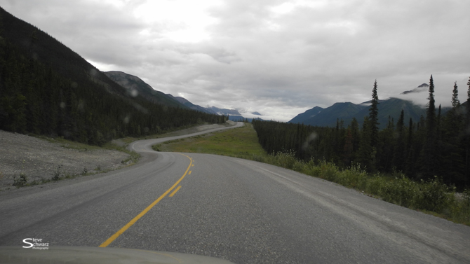
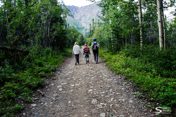
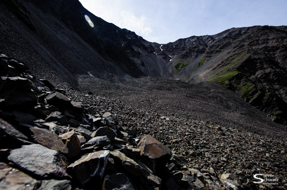
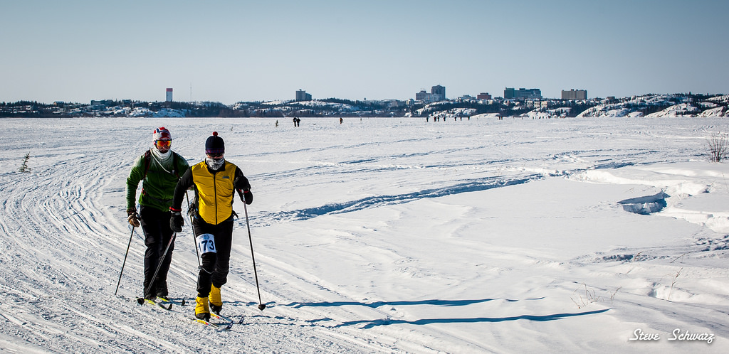
The event, it is not called a ‘race’ started at 10am and the Yellowknife Ski Club with a 500 meter loop through the stadium area in front of the chalet (to spread out the group, and for the benefit of the spectators) then down the icy ravine onto Great Slave Lake. On the lake, it is approximately seven kilometers of directly in-you-face -40C something wind chill. I stopped a few times along this section to photograph the long stream of participants with the office towers of Yellowknife on the horizon. Already, at this point in the course, folks were getting cold. Even from a distance, I could recognize the circular motions of arms – trying to warm cold fingers, and hands on faces blocking the wind. There was even a fellow, with his hand in front of that part of the male anatomy. Time to move on.

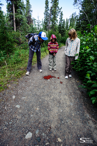
Following a five kilometer skidoo trail through the forest must have given them some respite from the wind, until Walsh Lake – a long narrow lake perfectly aligned with the wind direction. The first Check Point, at the 15km distance is the one I know well. Shawne and Rauri were hard at work checking bib numbers and faces. By this point, most participants had covered up their faces with ski goggles, scarfs, neoprene face masks and neck warmers. Most were ok, although the strong wind has a nasty way of finding even the small areas of exposed skin such as the tip of the nose that normally pokes out at the bottom of ski goggles. Some were not as lucky, having small patches of white skin on reddened check. Others even less lucky with long stripes of frostbitten skin caused by wrinkles in their face masks, and one fellow who as first was thought to have a pale completion and this turned out to be a face of nasty frostbite. Needless to say, his race was over as the First Aid folks did not let him continue. As participants came through the Check Point I photographed some of them, forever recording those enthusiastic yet frost bitten faces.

The cold was also having an effect on my camera gear, and every few photos the viewfinder would stay black (the mirror had locked in the up position), and the LCD display read ‘err’. I now know what error message means, it is the cameras way of saying it is too darn cold and that the cameras normal operating temperatures range is no lower than 0C. A good time to leave the camera in my coat and let it warm up. By then, it was nearly 12:15, and in the distance back along the course we could see some participants had not yet completed the first section. For safety reasons, the Check Point is scheduled to close at 12:30, and those that had not yet past through the Check Point by that time would not be allowed to continue. It seemed like a good time to move on, as I did not want to be around or photograph the stragglers coming through after 12:30.

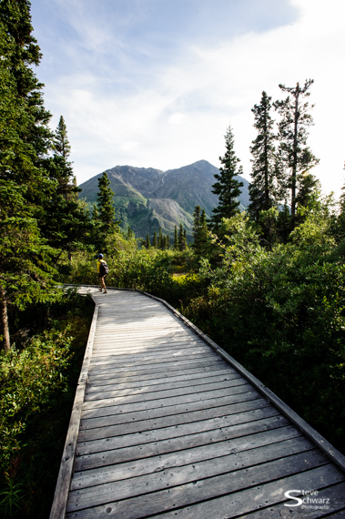
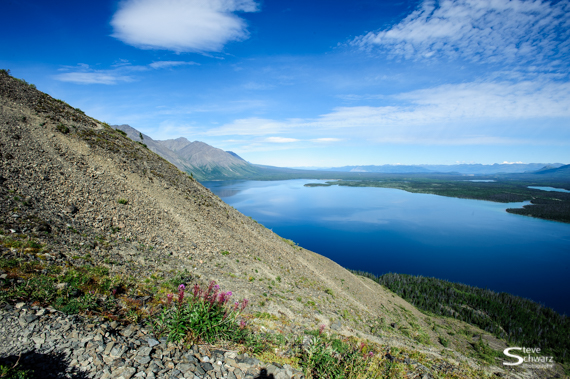
The course continues directly upwind to the end of Walsh Lake, then up over a hill and down to Prosperous Lake. From there I could see a long line of skiers and runners enduring a crosswind reroute to Check Point 2. Most of these folks I had already photographed at Check Point 1. Since my plan for the day was to photograph different participants at different parts of the course, I took a short cut and headed down wind towards Check Point 3 at the south end of the lake. On the way, I could see skiers and runners as tiny specks in the distance. Not far from Check Point 3, I noticed some incredibly scenic cliffs perfect to photograph the participants as they past in front. Not wanting to wait in the wind for the next skiers or runners to arrive, I sought shelter and found the perfect spot. There, out of the wind and actually being warmed by the sun were two volunteers from the Yellowknife Skidoo Club. We chatted and every 10 minutes or so I pushed down the visor of the skidoo helmet and peeked up wind to look for and photograph the next skier or runner as they passed by. Without the visor, the wind wanted to instantly freeze my eyes. Fortunately I had brought two cameras. The first was now completely dead. Even with extra batteries (I had bought 5 extra batteries) the LCD screen was blank. By 1:30 the second camera was starting to lock up and show the now all to familiar ‘err’ message on the LCD screen. A few photos later and it also went completely dead. Both cameras were now inside my coat – stone cold, and useless.

My job was to photograph the event, and by this point for most participants were still on the trails and had several hours to go before they completed the course. Without a camera, my contribution to the event was over. Being asked to retire from the event due to frostbite is one thing, as a photographer being forced to retire due to frozen cameras is another. By the time I got home at 4pm, not only were the two cameras still frozen, frost on the inside of my skidoo helmet had frozen my beard. A few tugs, and off came the helmet along with a tuft of beard hairs (just the grey ones right). My neck warmer had also frozen to my beard, tugging on it would have yanked out most of my beard hairs – outch. By 6pm I have thawed, the cameras have thawed (and are now working again), photos have been viewed, and I can’t help think about the folks that are still out there, the participants and volunteers.

Frozen cameras aside, it was again a rewarding experience to be a volunteer at Frostbite 45. This is however my last. Many participants in the Frostbite 45 have taken the time to stop, and say ‘thanks for helping’, then continue the course. Thanks folks. I would also like to thank the crew that organizes and sets up the event year after year; Shawne, Damain, Michael, Elaine (‘Master Tracker’, Tom, the volunteers at the Check Points, and the many clubs (Yk Skidoo Club, Amateur Radio Society), and all companies that provide products, services and people to make the Frostbite 45 a safe and successful event.


Selected photos of frosted and frostbitten faces on participants can be seen on my Flickr page