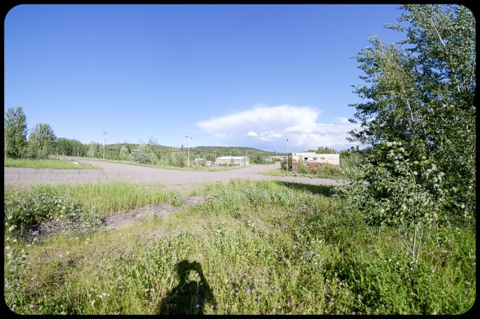
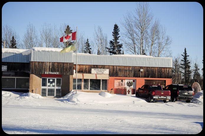
Roadtrip in Alberta + BC **Best 12

Ask a photographer to pick their best images from a solo two week roadtrip in Alberta and BC. Humm. I took thousands of photos with my ancient Nikon D700 and Samsung cell phone. I was traveling in my ancient 1991 FJ80 Toyota Landcruiser. Fall colors were absolutely amazing – perfectly timed, and there was almost no one else on the road. I took the Forestry Trunk Road (Alberta #40 / #732) on and off from Hinton to Coleman. Details in previous posts. 

My selection for best 12 photos.

20231003_181444-01

Picture 1 of 12

TRIP REPORT – Alberta 93 (Castle Junction to Wasa Lake + Whiteswan Provincial Park

October 5, 2023

This route followed Alberta highway 93 Castle Junction to Wasa Lake through Kootenay National Park. Unfortunately, this was the last day that the Trans Canada Highway was closed between Castle Junction and Lake Louise. As you can imagine – the road was stupidly busy !.


Whiteswan Provincial Park

A long and poorly marked forestry dirt road to Whiteswan Lake. Arrived late in the evening, needed flashlights to cook dinner and set up the tent. During the night, the elk were calling, and there was one splashing in the lake quite close to my campsite. The morning, calm and foggy. Pulled out the tripod for the first time in the trip, to photograph the foggy – almost mystic scene. Later, a person fishing in the lake surrounded by fog and a slowly rising sun.

TRIP REPORT – Canmore + Alberta 742 + Alberta 40 loop

October 4, 2023.

This post describes the Canmore + Alberta 742 + Alberta 40 loop. The route heads south on Alberta 742 from Canmore, passes Spray Lakes Reservoir, Spray Valley Provincial Park – Peter Lougheed Provincial Park and returns via Alberta 40.

TRIP REPORT – Forestry Trunk Road (Hinton to Ghost Valley)

I’d been looking forward to solo roadtrip to the mountains since I had left my Toyota Landcruiser in Edmonton after the mass evacuation in August.  The truck was already packed with camping gear, clothes and food. Being retired I could take a road trip and hit some of the best fall colors in the Alberta.

My truck is slow (the story goes that 1991 FJ80 Landcruisers will only reach 100km/hr going downhill), and not wanting to drive at length on the Trans Canada Highway, secondary and tertiary roads are my preference. As this was also my first solo trip, and my first lengthy road trip with the Landcruiser.  I didn’t want to go on off-road trails, or technically challenging routes. This was to be a ‘Shake-down’ trip.


On October 1, with the truck fuelled up (plus 30l in extra fuel) and coffee in hand, I pointed the truck west to Hinton.

Having read reviews for the Forestry Trunk Road I was confident the road would be fine, if not quite dusty. The Forestry Trunk Road (FTR) runs for 1000 kilometers from Grande Cache to Coleman in the Crowsnest Pass. Most of the road (~800km) is gravel and the remaining 200km is  paved. The FTR was a north-south resource road, some segments of the road have been designated as parts of Highway 40 or Highway 734. The Forestry Trunk Road runs mostly through Crown Land, it is possible to camp just about anywhere, or in provincial campsites. 


This post describes the route from Hinton via Nordegg to Ghost Valley. I did a modified route. From Hinton taking the Robb Road and Pembina River Road  joining the Forestry Trunk Road near McLoed River. According to Google Maps, this is a 6 hour 51 minute (440km) route. I took three days- beautiful scenery and washboard roads made the drive quite a bit longer than expected. 

Day 1: October 1, 2023. 138km

The Pembina Road runs through appropriately named ‘Coal Valley ‘; coal mining, logging, oil and gas wells.

Camped at McLoed River.

Day 2: October 2, 2023.

To Nordegg and beyond. Google maps did not record the entire route.   I camped near the green dot shown on the map.


Day 3: October 3, 2023.

Camped on the Ghost Valley Road overlooking the Ghost River.

Summary. This route is highly recommended. I was especially fortunate, as the road conditions were good, and the fall colours were superb.  Additionally, there were very few vehicles on the road. Other drivers on this route had mentioned an abundance of industry-related vehicles.

Another post will highlight the Canmore + Alberta 742 +  Alberta 40 loop.

Ruby Falls. September 30, 2023

Road trip to Ruby Falls, Alberta on September 30, 2023.  Driving into Ruby Falls isn’t for the faint of heart, or for cars (4×4 truck is a necessity). I drive a 1991 Toyota Landcruiser FJ80, and joined a Jeep YJ, and a Jeep Cherokee. The other drivers were experienced off-roaders, and one had done the drive several times. Prior to the trip, I asked  – “Is off-road driving experience necessary for this trip ?”. The trip guide, replied, ‘not really’.   I now know !.

According to Google, our driving day was 7h:59 min, drove 128.28km, average speed 16 km/hr, and ‘on a ferry’ for 108km !!. There were no ferries !.

Pictures: Nice and clean before the trip …..to time for a wash, and there is a licence plate somewhere under that mud !


Measuring of Coastal Erosion at Baillie Islands (Cape Bathurst)


Location
Baillie Island is located at the northern tip of Cape Bathurst, the most northern portion of mainland NWT.

This area is of importance due to the occurrence the rare hairy rockcress or hairy braya (Braya pilosa, genus Braya of family Brassicaceae) that is observed at five locations on the Baillie Islands and Cape Bathurst.

Methodology
Two different methods were used to measure coastal erosion on Braille Islands. Both methods use an early and later (most recent satellite image). The measure distance between the coastline of earlier and coastline of the later satellite image is inferred to be the amount of coastal erosion between the date of the earlier image and the date of the later image. The difference between Method-1, and Method-2 is the time span between the earlier and later image, and the resolution of the satellite imagery. Method-1 uses the earliest available moderate resolution (30m) Landsat satellite imagery 1985-2021, where as Method-2 users the higher resolution Sentinel-2 (20m) using available dates (2017-2021). Five (A-G) cross sections were used for measuring the distance between the earlier and later satellite image. This was done in ArcGIS Pro. The process of measuring involves subjective interpretation in respect to measuring a smooth surface (thick blue line) of a raster (pixelated) image (see image below).

As Sentinel-2 imagery has a finer resolution than Landsat (20m vs 30m) the pixels are smaller, and thus assumed to be closer to the smooth surface representing the actual coastline.

Measured distances between the earlier and later satellite images were divided by the time interval between the earlier and the later images, and shown in red in the following Figures.

Method-1
This method uses Landsat (1985-2021) imagery for measuring of coastal erosion.

Method-2
This method uses available Sentinel-2 imagery.

Summary
Noting that the date range for Method-1 spans 36 years and 4 years in Method-2, the measured distances at the five cross sections differ significantly. There may be a number of reasons, including the coarser pixel size of the Landsat imagery, and corresponding errors in the subjective interpretation of the measurement between the earlier and later images. There is the possibility that there has been an increase in coastal erosion during the later time interval, thus shewing the averaged erosion rate when divided by the time interval between the earlier and later images.


Ice roads on Great Slave Lake

Easter long weekend cruise on the ice roads on Great Slave Lake (Yellowknife, Northwest Territories).
This 110km long and 1.1m thick ice road heads from Yellowknife to the Vital Metals Ltd. Nechalacho rare earths project at Thor Lake near the Hearne Channel of Great Slave Lake. All heavy equipment for the mine was transported on this road.

On Saturday (May 8th) the light was poor and road conditions made road difficult to drive. Actually quite difficult to see the road. On Sunday (May 9th) the road was freshly plowed and sunny sky. We drove the Yellowknife – Devils Channel (Gros Cap) section (75km) and skied 11km in Devil’s Channel that separates Gros Cap from the mainland. No other traffic on the road. On the return, due to the warm temperatures in the afternoon and cooling evening temperatures the large and deep puddles on the crystal clear ice were partially frozen – peppering the hood and windshield with chunks of ice. The ice road was closed 12hours after we got home.

Anticipating that things can go wrong on a remote ice road, we brought safety and survival gear, including the rooftop tent, -30C sleeping bags, warm clothes, food, stove, inreach, extra fuel, winch, ice screws, towing strap, and Maxtracks. 

Pictures from Saturday:

Pictures from (sunny) Sunday:

Wilson Switch & New-to-me BJ60

The “joys” of buying something old. It could be a house or a vehicle. There is the realization the previous owner made some changes “renos” that- Well, sure could be done differently. 

This 1985 Toyota BJ60 Landcruiser had a Wilson switch installed – sort of. They didn’t remove the Toyota installed Superglow system and added a few wires to resemble the Wilson Switch.  One of the wires was jammed under a fuse in the fuse box, and they used a on-off switch instead of a push-on (momentary) switch.  Did they swapout the 12v glowplugs from the Superglow system for the recommended 10.5v glowplugs for the Wilson Switch?

For those that don’t know what the Superglow system is, or what the Wilson Switch is – They are different ways of warming up glowplugs in a diesel engine. 

Opening up the dashboard,  steering column and drivers side kick plate to figure out what the previous owner had done, and install the Wilson Switch. 


Climate Trends

The past couple of months I have been writing code in Google Earth Engine (GEE).  For those that don’t know what GEE is – in brief is a database of satellite imagery and a code window to create a run scripts. Data can be uploaded to the GEE platform, and exported (downloaded).  The database of satellite imagery includes recent (today) and historical data (as far back as 1972) depending to the type of satellite. Landsat data is continuous from 1972 – current, Sentinel 1 (2014- current), Sentinel-2 (2016-current), and other satellites have shorter time periods (2000-current). In essence, the availability of historical data provides a means to “move back” in time, where as the current and yet-to be collected data provides a means to move forward in time.

Air temperature Trend (2000-2020)

Air temperature Trend (2000-2020)

In this post I will demonstrate a couple of GEE Mapping Tools that I created in GEE to illustrate 20 year Trends (2000-2020) in Air Temperature, Snowfall/snow depth/density/temperature,  and Lake ice-temperatures across the NWT.

NWT Snowfall Trend (2000-2020)

Click on the links below to view the Mapping Tool

NWT Climate Trends Mapping Tool

NWT Snow Trends Mapping Tool

NWT Lake Trends Mapping Tool


Zion, Capitol Reef, Canyonlands and Arches National Park (Color)

A typical photospread. No need to add much text, as there are are plenty of more wordy places to learn about Zion, Canyonlands and Arches National Park.  I didn’t even include a map (seems odd for a guy that makes maps for a living).

Cameras used; Leica M240 with Leica-R 19mm, and Fuji X-Ti with Fujinon 14mm


Zion National Park

Capitol Reef National Park

Canyonlands National Park

Arches National Park